


Green Square, stretching across Beaconsfield, Zetland, Rosebery, Alexandria and Waterloo, is being reshaped into one of the country’s largest new urban communities, set to welcome about 63,000 residents once construction is complete.
A new chapter for Inner Sydney
What was once a district of warehouses and industrial yards is undergoing one of the most ambitious urban renewal programs in Australia. Covering 278 hectares, the Green Square project is valued at $22 billion in private development, with the City of Sydney investing $1.8 billion in public infrastructure. The City has already delivered more than $700 million worth of projects, with another $80 million planned in the next five years.
The redevelopment is not simply about building apartments. The goal is to create a neighbourhood where people can live, work and spend time together, with a strong emphasis on sustainability, community spaces and accessible services.
Homes and jobs for a growing population
Once complete, Green Square will provide 33,000 new homes across the five suburbs. Around 63,000 people are expected to move into the area, nearly doubling the population of Sydney’s inner south. The project is also forecast to generate up to 22,000 permanent jobs, creating opportunities for residents to work close to where they live.
The scale of change is already visible. Zetland and Waterloo have seen new apartment towers rise over the past decade, bringing young professionals and families into the area. Shops, restaurants and cafés have followed, reshaping what were once quiet industrial streets into active neighbourhoods.
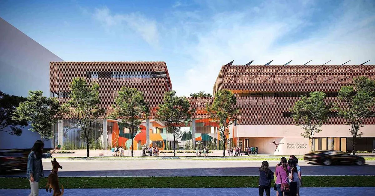
Community facilities at the heart of planning
Beyond housing, the City of Sydney has prioritised new public infrastructure to support daily life. Green Square Public School is set to open in 2025 on the former Royal South Sydney Hospital site at 3 Joynton Avenue. The award-winning Green Square Library and Plaza has already become a community hub, while the Gunyama Park Aquatic and Recreation Centre is providing new opportunities for health and sport.
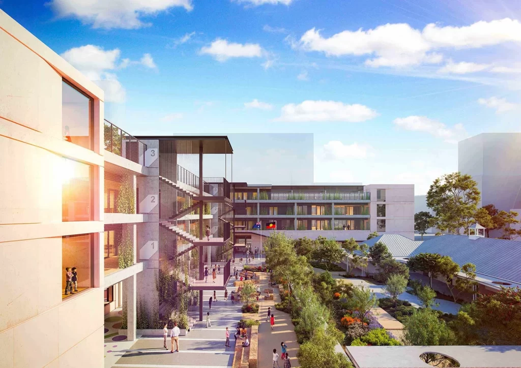
Open space is central to the vision. More than 40 parks and playgrounds are being created, giving families access to outdoor recreation and places for neighbours to meet. The former Royal South Sydney Hospital site is also home to the Joynton Avenue Creative Centre, preserving a cultural link to the area’s past.
Designing for sustainability
Green Square has been planned with long-term environmental goals in mind. It hosts one of Australia’s largest residential stormwater harvesting and reuse systems, designed to capture and recycle up to 320 million litres of water a year. Energy-efficient LED street lights line the precinct, while self-watering raingardens reduce water use and improve the health of local plants.

The development’s commitment to sustainability has earned it a 6 Star “Green Star – Communities” rating from the Green Building Council of Australia — the highest level achievable. This recognition highlights the integration of green design into housing, infrastructure and open spaces.
Moving around the city
Transport has been a major consideration in the renewal. The Green Square train station connects directly to the Sydney CBD and airport, making it one of the best-served suburbs for public transit. City planners have also prioritised cycling and walking, with separated cycleways and wide footpaths encouraging active travel.
The City of Sydney is advocating for a new light rail link between Green Square, Central and Parramatta Road/Broadway.
Balancing growth with community needs
With such rapid development, concerns have also been raised. Housing affordability remains a challenge, as new apartments are often priced beyond the reach of many long-term residents. Increased population density will also put pressure on transport networks, schools and health services if growth outpaces planning.
City of Sydney officials acknowledge these challenges but emphasise the scale of investment being made in community facilities and open space. The goal is to ensure Green Square develops as a balanced neighbourhood rather than just a cluster of high-rise buildings.
A model for the future
Green Square is being closely watched as a test case for urban renewal in Australia. If successful, the project could influence how other cities approach redevelopment, combining sustainability measures with housing growth and public infrastructure.
For residents of Beaconsfield, Zetland, Rosebery, Alexandria and Waterloo, the changes are more immediate. In place of warehouses and factories, new parks, libraries, shops and homes are taking shape. The project is reshaping not just the skyline, but the way people live and interact in the heart of Sydney’s inner south.
| Category | Details |
| Location | 278 hectares across Beaconsfield, Zetland, Rosebery, Alexandria, Waterloo |
| Purpose | Major urban renewal project – transforming old industrial area into sustainable, mixed-use community |
| Population & Housing | ~33,000 new homes; ~63,000 residents when complete |
| Jobs | ~21,000 permanent jobs expected |
| Sustainability | Stormwater recycling scheme (one of Australia’s largest); LED streetlights; self-watering raingardens; cycleways, wide footpaths |
| Green Star Rating | 6 Star “Green Star – Communities” rating (highest possible) |
| Public Infrastructure | – 40+ parks, plazas, and playgrounds- Library, plaza, aquatic centre, community spaces- New primary school- Redevelopment of old Royal South Sydney Hospital site |
| Transport | Cycling network, integrated public transport, planning for light rail |
| Funding | Private development: ~AUD $22 billionPublic infrastructure: ~AUD $1.8 billion (City has spent $700m, with another $80m planned) |
| Overall Goal | Create a vibrant, sustainable, well-connected urban community with housing, jobs, green space, and amenities |
Published 16-Sept-2025